
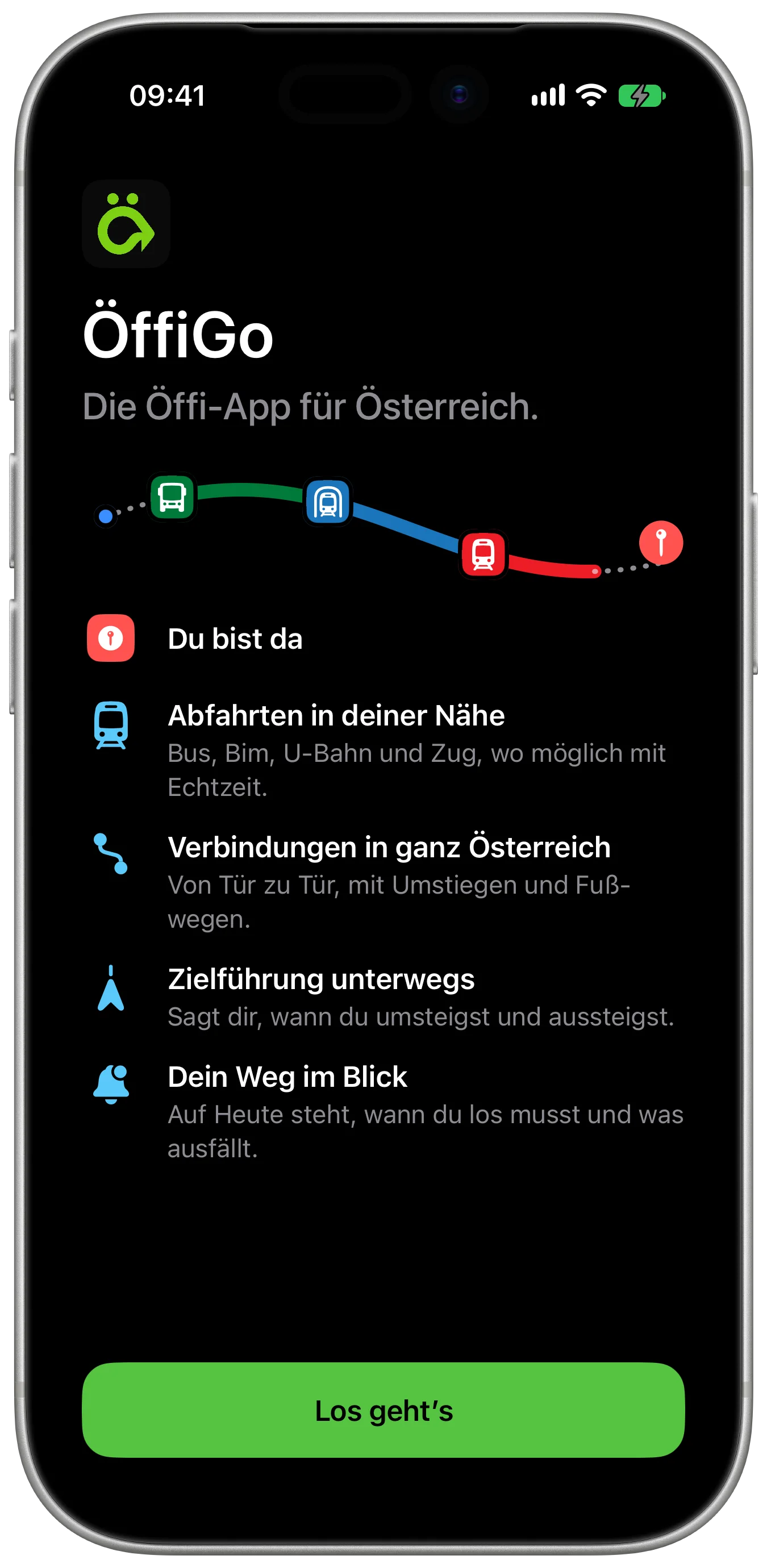
The public transport app for all of Austria.
Every dot on this map is a stop. Find yours, the departures are real.
Closed beta on iPhone, free during the beta. The app is in German.
One trip, Graz to Vienna.
From Jakominiplatz to Praterstern, by tram 7, Railjet and U1. The screens are from the app, captured for exactly this trip.
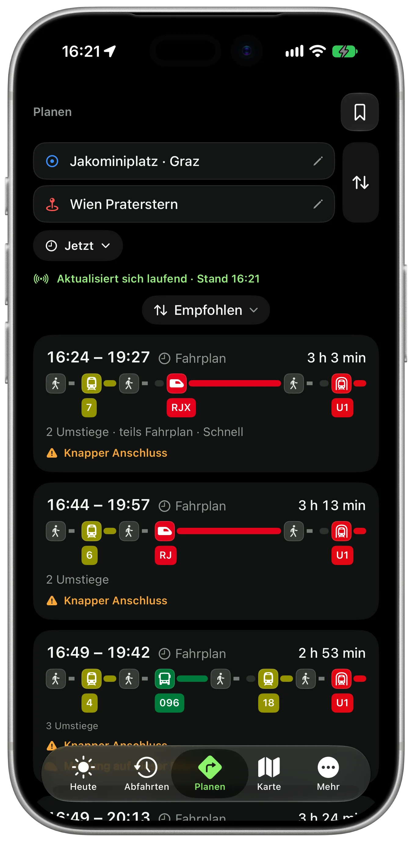
Say where you're going
From Graz Jakominiplatz to Vienna Praterstern. ÖffiGo lists the connections with duration and changes, and warns when a connection is tight. We take the 16:24.
7
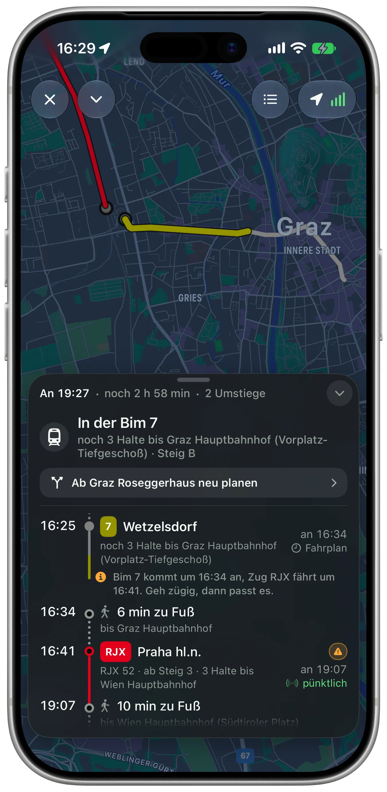
Tram 7 to the main station
Guidance is on. At the top it shows how many stops are left, below it the whole plan to Vienna. Six minutes on foot to the 16:41 Railjet: ÖffiGo tells you on the tram that you'll make it.
RJX
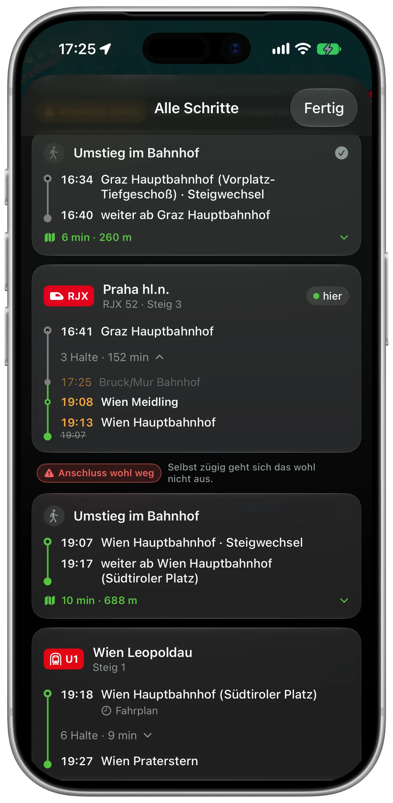
On the Railjet to Vienna
At Bruck an der Mur the Railjet leaves six minutes late. The trip view shows it at every stop: Wien Meidling 19:08, Wien Hauptbahnhof 19:13 instead of 19:07.
The timetable times are real; the delay from Bruck is simulated.
U1
Connection rescue
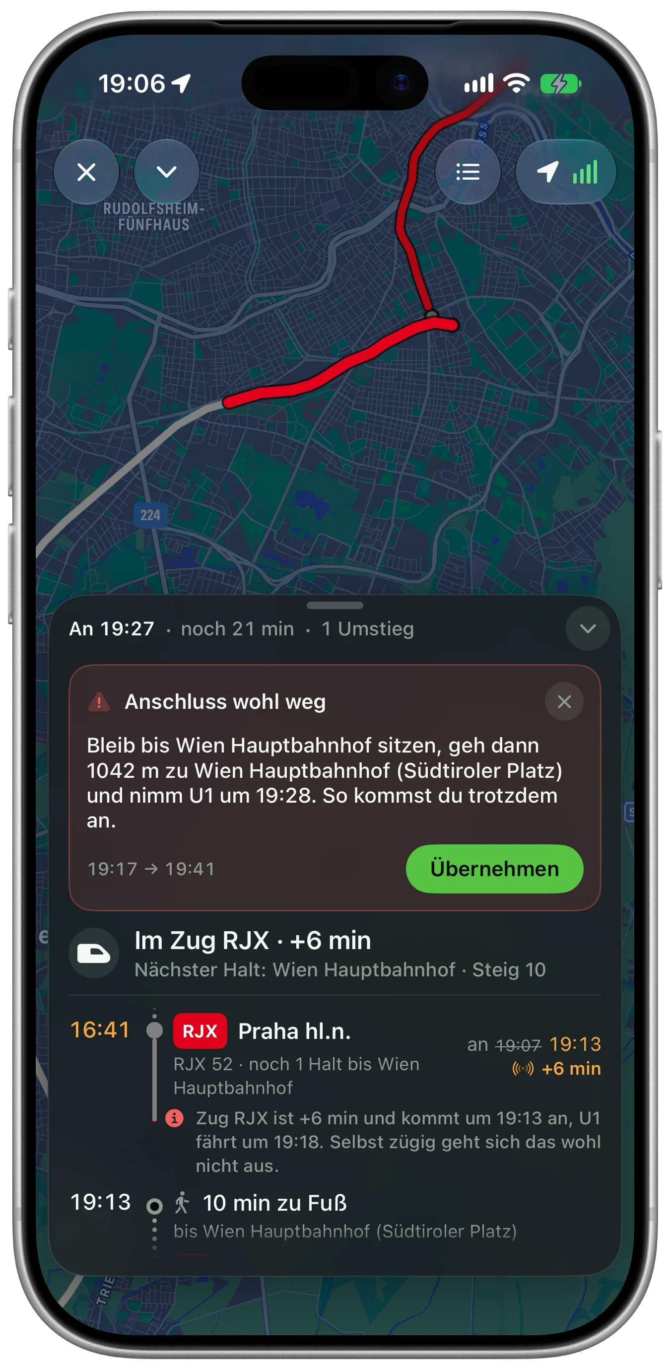
The U1 is out of reach
Arriving at 19:13 instead of 19:07, even hurrying won't get you onto the 19:18 U1. ÖffiGo sends one notification, even with the iPhone locked, and already has the next one: stay seated, 1042 metres to the U1, leaving 19:28.
How ÖffiGo decides
- Two levels
- “Tight” means you'll make it if you hurry. “Probably gone” means even hurrying leaves you more than half a minute short. Only then do you get a notification.
- Your walking pace
- ÖffiGo measures it on the walks during guidance. The iPhone keeps only an average, with no places or routes, and you can delete it.
- Only when it helps
- While a connection is only tight, another way appears only if it gets you there at least three minutes sooner. Getting off early is suggested only from five minutes on.
- All clear
- If the train makes up time, you get “Anschluss klappt doch” (connection works after all), and the earlier notification disappears.
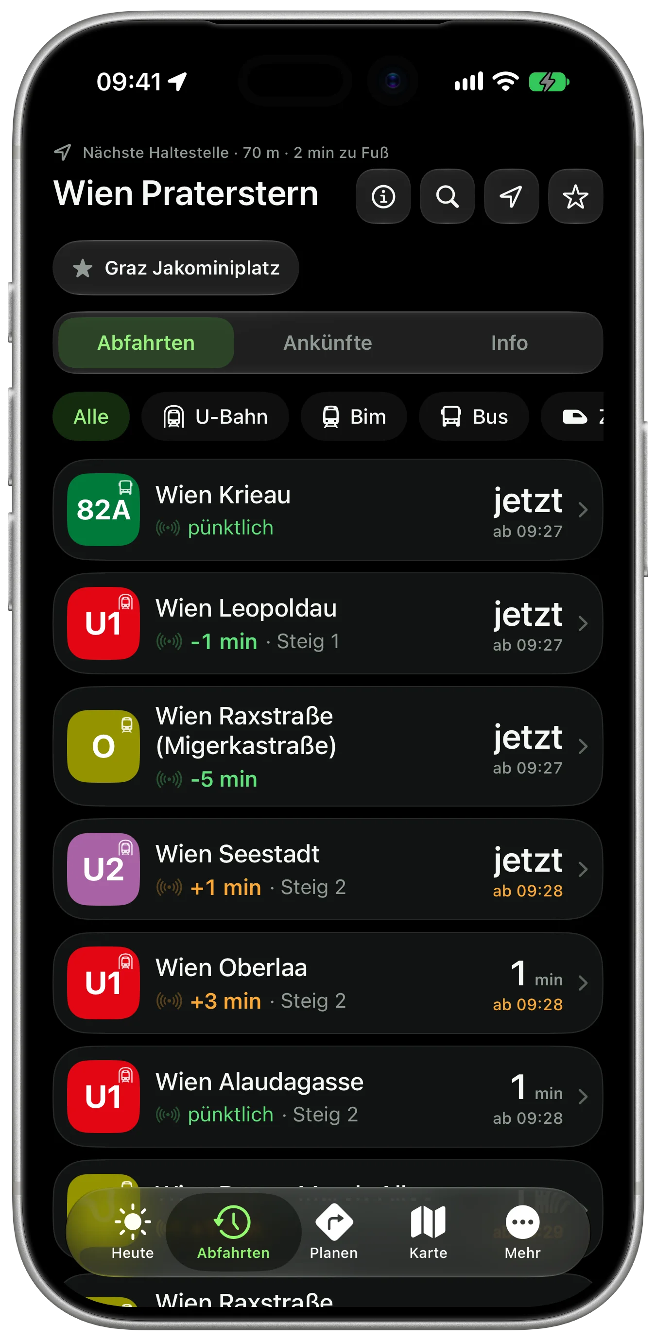
Arrived at Praterstern
At Praterstern ÖffiGo shows what leaves next: metro, S-Bahn, tram and bus, nearly all in real time. The same app as at Jakominiplatz.
Today on the network.
Disruptions, construction and lift outages from every province. Each needle on the model is a current notice, where it applies.
227 current notices
- 61 Disruptions
- 122 Construction
- 40 Lifts
- 4 Other
Notices without a place are missing from the model; the list has them all.
See all disruptionsÖffiGo measures how far public transport drifts from the timetable: in Vienna, in Styria and for every train in Austria.
80.4 %
of measured stops in Vienna and Styria were on time, meaning at most one minute early and three minutes late.
Last 30 days, through 15 November 2026.
Look up your lineWhat ÖffiGo does.
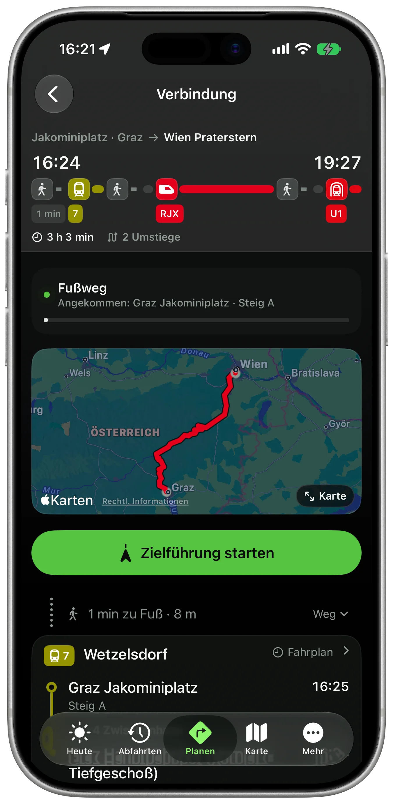
Planning
A to B across Austria, with real walking legs.
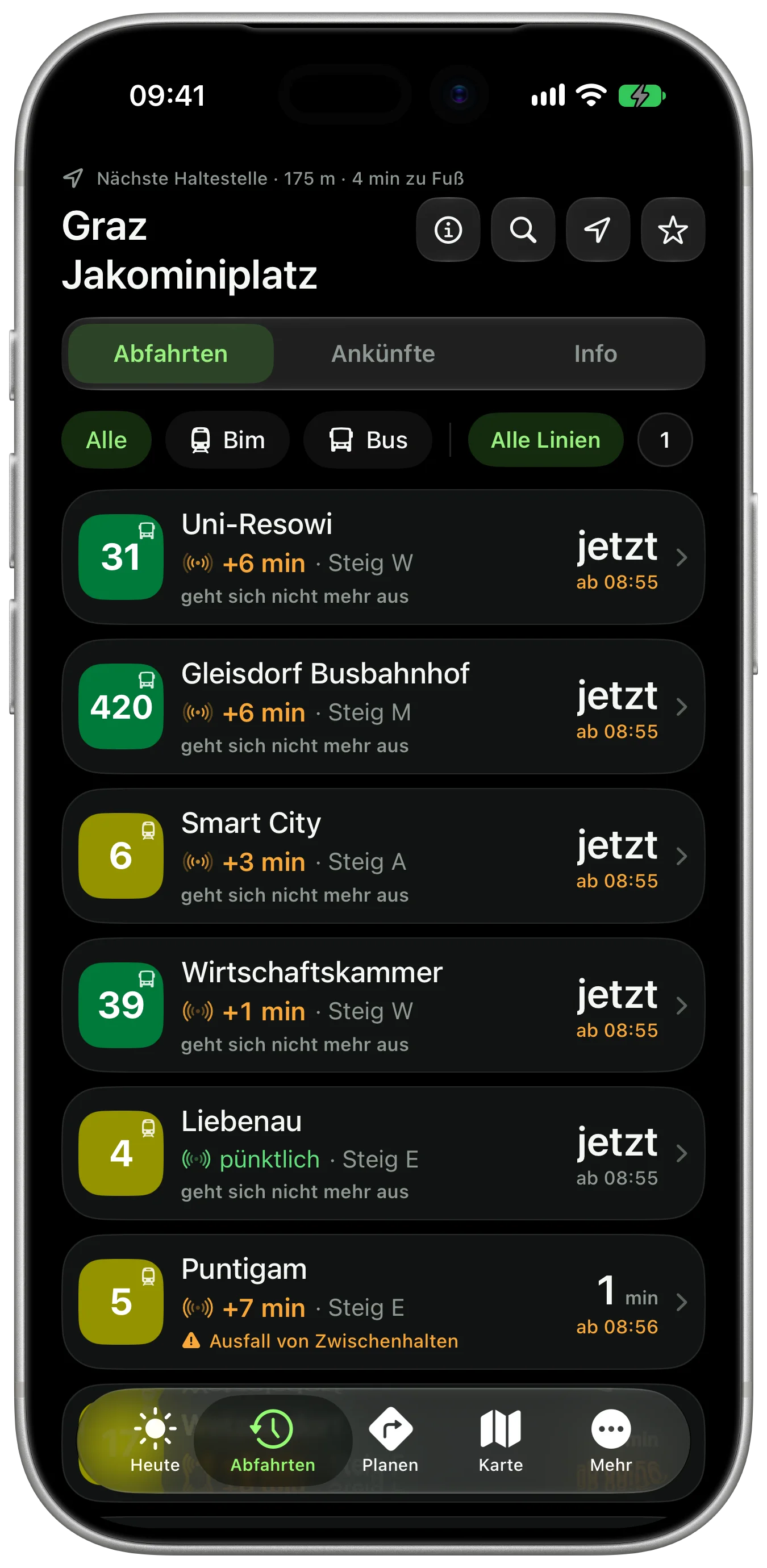
Departures
Any stop, with realtime where it exists, otherwise the timetable.
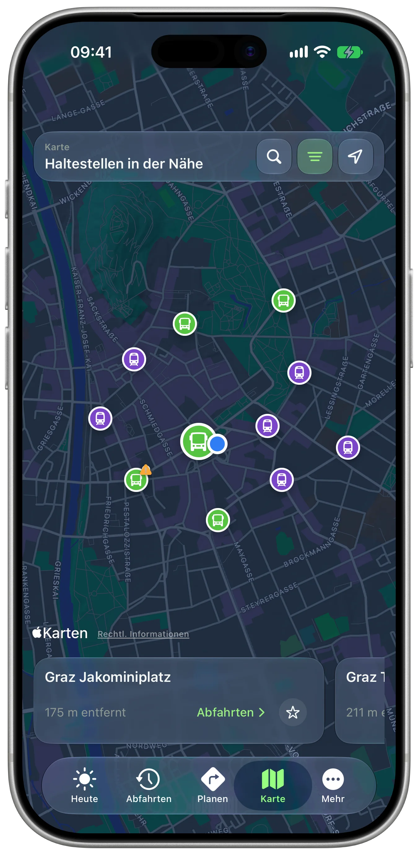
Map
Stops and lines around you, in the operators' colours.
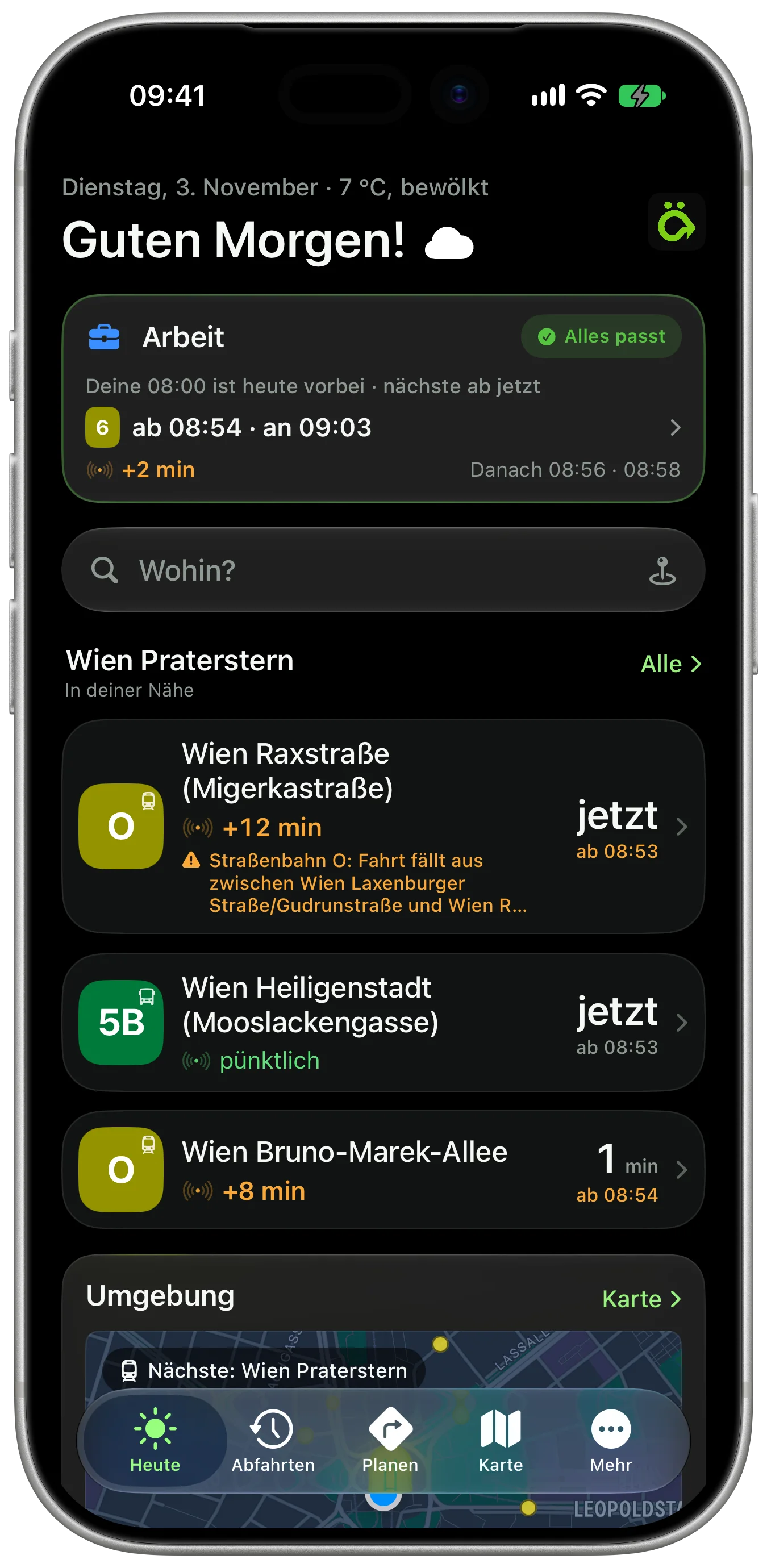
Saved routes
There and back as a favourite. The direction picks itself.
On the lock screen
Next stop and transfer, without unlocking the phone.
Apple Watch
Its own app on your wrist, with a watch-face complication.
Watch a trip
Checked every two minutes, even with the app closed, and more often as your next change gets closer. You hear about delays, platform changes or a replacement bus before you're on the platform.
Also:
Routes inside stations, Follow along, Widgets, Regional network maps, Works offline, On-device statistics, Coins and achievements.
Ask ChatGPT or Claude where your bus is right now.
Connect ÖffiGo to your assistant and ask about departures, connections and delays. Answers come with real time where it exists. You need a ÖffiGo account for this, and access is opened one account at a time.
How to connect ÖffiGoAPI
Building something yourself? The same data is available through the open API.
API docs
Supported by
ÖffiGo is a non-commercial student project. These partners provide data and services for it.
More about the supporters Primary data sourceVerkehrsauskunft ÖsterreichPlace search, timetables, routes and embedded disruption alerts. VAO supports ÖffiGo, a student project, with access to its services. Thank you.verkehrsauskunft.at
 Disruption alertsMobilitätsverbünde ÖsterreichDisruptions from all of Austria arrive through the IMS API. ÖffiGo shows the ones that touch your routes.mobilitaetsverbuende.at
 Network & protectionCloudflare for StartupsEvery request from the app runs through Cloudflare's network. It protects the ÖffiGo API and keeps frequent answers close to you.cloudflare.com/forstartups
Request a beta place.
A closed group is testing through TestFlight right now. Sign up and we will get in touch as soon as a place opens up.
The security check runs on Cloudflare Turnstile. Privacy (German)
What people ask.
Why ÖffiGo if I already use Google Maps, Scotty or BusBahnBim?
ÖffiGo plans door to door anywhere in Austria, including the countryside, says for every time whether it comes from the operator or the timetable, and suggests another connection during guidance when a change won't work out.
What does ÖffiGo cost?
Nothing during the beta, every feature is free. What applies after the beta is not decided yet.
How do I get into the beta?
Through the “Request a beta place” form on this page. The beta runs closed on TestFlight for iPhone. Signing up is a request for a later place, not a promise. When one opens up, you get an email.
Is there an Android version?
Not yet. Android development is currently paused, so for now ÖffiGo is iPhone only.
Are the times live?
Wherever the operator reports realtime, yes. Every departure says where its time comes from. Where nobody reports realtime, you see the timetable.
Who makes ÖffiGo?
Johannes Grof, as a school project. Verkehrsauskunft Österreich supports it with access to its services.
Map: OpenStreetMap contributors (ODbL), elevation: Mapzen Terrain Tiles, exaggerated five times.